
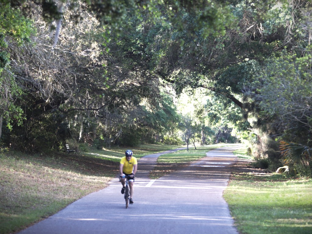
There is a different way to get to know North Pinellas County, and you won’t need your car to do it.
The Pinellas Trail runs from the top to the bottom of Pinellas County. Originally a railroad bed, it has opened up new ways for walkers, runners, and bikers to enjoy the outdoors. You can use the trail for a brisk 15-minute walk near your home, or spend an entire day walking (or running or biking) through a number of area communities.
A railroad’s second life
The Fred Marquis Pinellas Trail grew from an abandoned railroad corridor. In the 1980s, county residents and bicycle advocates saw the possibility of a safer place to walk, jog and cycle, while the county faced the question of what to do with approximately 34 miles of former CSX railroad right of way. Bert Valery, whose son had been killed while bicycling, joined Brian Smith and then County Administrator Fred Marquis in advocating for the trail.
The first five-mile stretch opened in 1990, between Taylor Park in Largo and Seminole Park. Support for additional sections grew, aided by the Penny for Pinellas sales tax. The trail now carries Marquis’s name in recognition of his role in turning the idea into reality. The level, gently curving route still hints at its railroad past, although not every mile of today’s wider network follows the old rail bed. Pinellas County trail history
How far does it go?
The entire trail runs for 47 miles, from downtown St. Petersburg north to Tarpon Springs. Along the way it serves communities including Gulfport, South Pasadena, Seminole, Largo, Clearwater, Dunedin and Palm Harbor.
Pinellas County uses that 47-mile figure in its trail guide. Other county pages describe a longer network, including newer connecting segments; the proposed 75-mile Pinellas Trail Loop is a separate, larger project, not the distance between St. Petersburg and Tarpon Springs. Pinellas County trail guide · Pinellas Trail Loop project
Pinellas County Parks & Conservation Resources oversees the trail’s maintenance and operating costs. County park rangers and a multiagency security task force patrol it, while Friends of the Pinellas Trail supplies volunteer support and amenities.
The county says an average of 160,000 people use the trail each month. That is a measure of how thoroughly it has become part of local life. County trail guide · County trail history
What it does for the towns along the way
In downtown Dunedin, riders and walkers can step off the path for coffee, a meal or a shop. In Tarpon Springs and Palm Harbor, it gives residents and visitors a way to explore at a slower pace. It links neighborhoods to parks and waterfront areas and offers an option for short trips without getting into a car. The benefit to nearby businesses is easy to see in the people stopping along the way.
For someone considering a move here, its value is also personal: Do you want a walk you can repeat without driving to a park? Would you use a bike to meet friends downtown? Is being near a path more useful to you than being near a beach you might visit only occasionally? The answers can help you choose between otherwise similar neighborhoods.
Yes, events use the trail
The Pinellas Trail Challenge is a roughly 46-mile ultramarathon; In Palm Harbor, the Glam Run 5K held its 12th annual event on January 31, 2026, using a section of the trail and gathering at Pop Stansell Park. Routes and dates may change, so check each organizer before making plans. Pinellas Trail Challenge · Glam Run 5K
The everyday scene is perhaps the trail’s most regular event: walking groups, neighbors exercising, cyclists passing through town and families enjoying a Florida morning.
Is the trail still growing?
Yes. The county’s longer-term goal is a 75-mile loop around Pinellas, joining the established western trail with eastern sections, including the Pinellas Duke Energy Trail. A 6.7-mile northern Duke Energy segment from Enterprise Road in Clearwater to John Chesnut Sr. Park in Palm Harbor opened in 2022. The bridge over the Lake Tarpon Outfall Canal, once an unfinished piece of that connection, is listed by the county as completed in 2026. Duke Energy Trail opening · North Gap bridge status
Work remains farther south. As of the county’s July 2026 update, the South Gap project between 126th Avenue North in Pinellas Park and Haines Bayshore Road in Largo had completed its first phase, while the second phase was in design. The county projected construction of that later phase from summer 2028 to summer 2030; schedules can change. The loop is also intended to connect with regional routes toward Pasco and Hillsborough counties and Florida’s Coast-to-Coast Trail network. South Gap project status · County regional trail plan
A few things to know before you go
The county lists trail hours as 7 a.m. to sunset. Keep right, pass on the left, announce your approach when passing, and stop at road crossings when signs or signals require it. Some sections have overpasses or underpasses, but the trail still crosses streets. Bring water and check the county’s current map and notices before planning a longer trip. Pinellas County trail guide and maps
The old railroad once connected Pinellas communities by train. Its second life connects them at walking and cycling speed. If you are deciding where to settle in North Pinellas, spending a morning on the trail may tell you more about the rhythm of a town than a drive through it ever could.
Want to know more? Beth would love to chat with you. 727-643-7100 or bethfrederickre@gmail.com .


Leave a comment